This blog post was SO close to being called "New Zealand's Worst Day Hike". During our hike of the Tongariro Alpine Crossing, Erik was plotting his guest post about the hype surrounding this hike, due to the fact that he was 0 for 2 in seeing ANYTHING on the hike because of poor weather conditions.
We woke up to a bit of drizzle, which did not leave us optimistic about the weather, but there were blue skies in Turangi, so I was hopeful that we would have blue skies in Tongariro National Park. My other half was not so optimistic, as he had been in a similar situation 10 years ago. When we started the hike, it was misting on and off and visibility was
poor but we could see a few hundred feet in front of us.
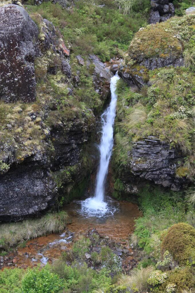 |
| Rain does make waterfalls look pretty! |
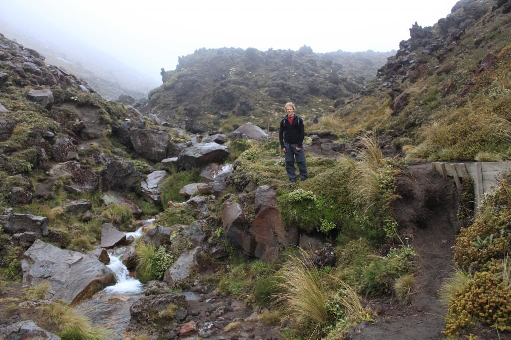 |
| First hour of the hike. Visibility slowly deteriorating. |
However, as we
started to climb, the conditions got much worse.
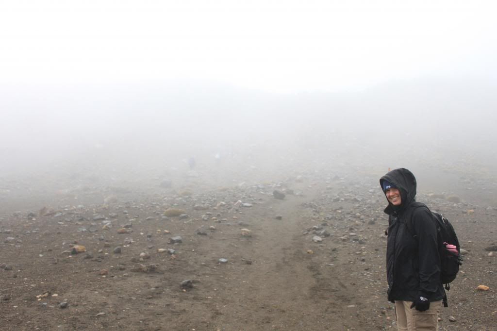 |
| Not much to see at this point! |
It was extremely cold and ridiculously windy, I had icicles forming on my jacket and at times I felt like the wind was actually going to blow me over. People who looked very fit and very well prepared (lots of layers for the rough conditions) were turning around, telling us the conditions ahead were worsening when we thought they were already as bad as they could be! We decided to tough it out, though there were many times when I wanted to head back in the direction of warmer temperatures and less wind. I still had a glimmer of hope that we might see some clearing.
When we arrived at the "top", we could see absolutely nothing except clouds. It was quite depressing because I had seen pictures of Emerald Lakes, Blue Lake, and Red Crater that looked stunning and we were unable to see any of those things. For Erik this was the second time he had hiked the crossing and seen nothing.
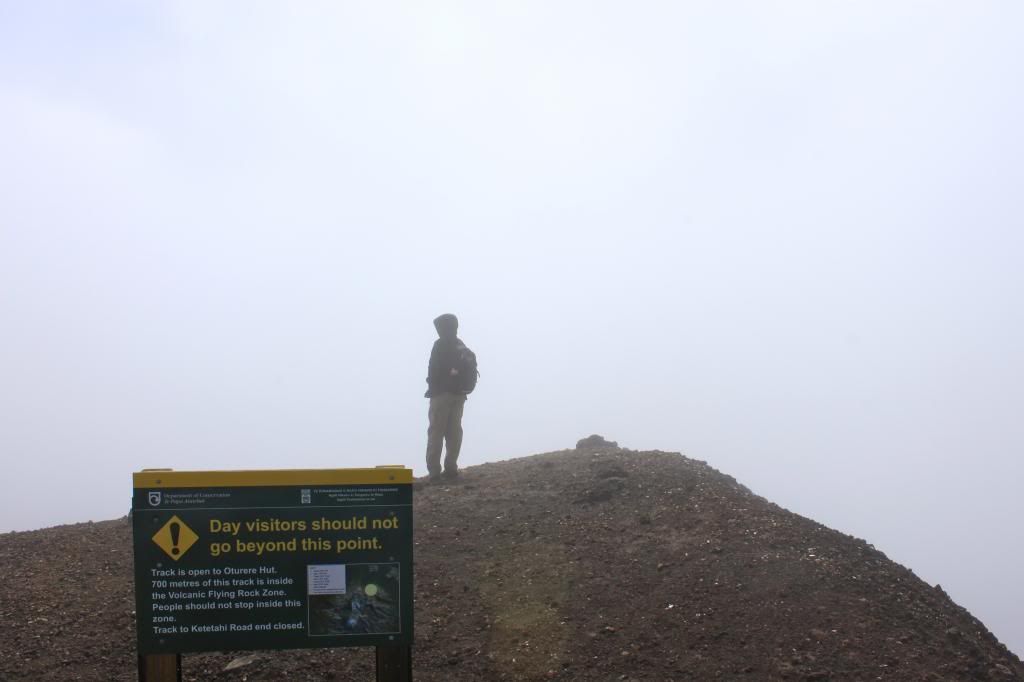 |
| Trying to determine where Emerald Lakes might be located! |
We stood there for about 5 minutes, thinking about how unlucky we were to hike in the miserable conditions only to not see anything as a reward, when suddenly we saw a glimpse of blue sky! Over the next 10-15 minutes, more patches were appearing and more people were getting to the top with hope that we might actually get a semi-decent view of our surroundings. About 20 or 30 minutes after reaching the top, the clouds just lifted, prompting clapping and cheering from fellow hikers. The sites were breathtaking. We were literally standing right on the edge of a massive crater but had no idea because of the poor visibility.
 |
| Clear skies...wooohoooo! |
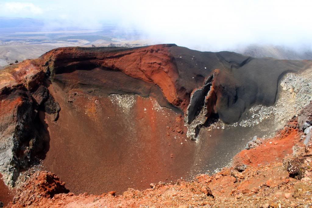 |
| Red Crater |
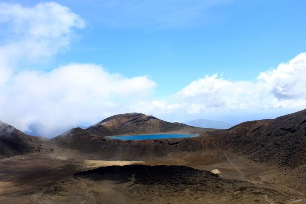 |
| Blue Lake |
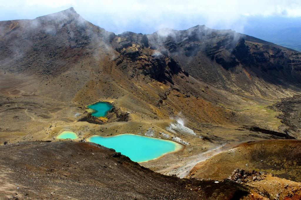 |
| Emerald Lakes |
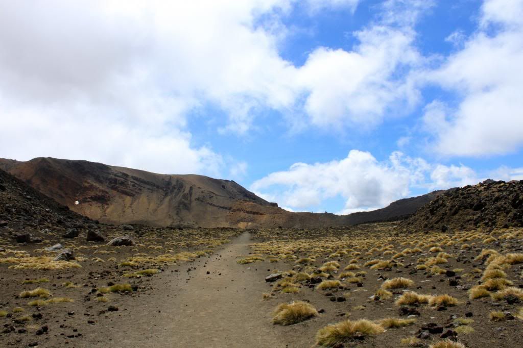
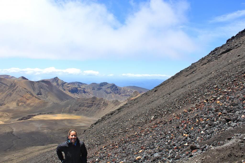
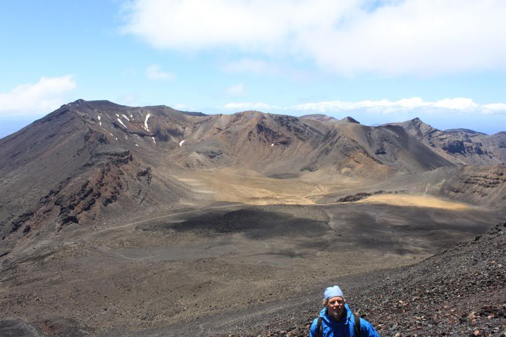
After enjoying the view for a while, we started our decent. Normally the crossing is a one way hike, but due to recent volcanic activity, it is currently an out and back. This was beneficial for us because now we had the chance to see all of the things we could not see at all on the way up!
 |
| This was taken close to the same spot as the picture above where I am standing in clouds/fog. |
When we reached the base of Mt Ngauruhoe (Mt Doom in Lord of the Rings), we decided that we should try to summit the mountain. Erik had also done this 10 years ago, but saw nothing once again due to poor weather conditions. The hike is meant to be 3 hours return, and unfortunately we only had about 1.5 hours total to climb if we wanted to make it back to the bus in time. The climb is quite difficult because the mountain is composed of rocks from former volcanic eruptions, and because of that there is no actual trail, so for every step I was taking I was sliding down some with the terrain. We got about 2/3 of the way up, but conditions were becoming poor (clouds moved in and the wind picked up) and we were running low on time, so we decided to descend. Of course, by the time we made it down to where the bus was picking us up, the clouds had cleared and for the first time all day you could see a perfectly clear Mt Doom. Even though we did not make it to the summit, we were provided excellent views of the surrounding mountains while on our climb.
 |
| View from the side of Mt Ngauruhoe. This provides some insight as to the steepness/terrain of the climb! |
 |
| Another amazing view seen from about half way up Mt Ngauruhoe. |
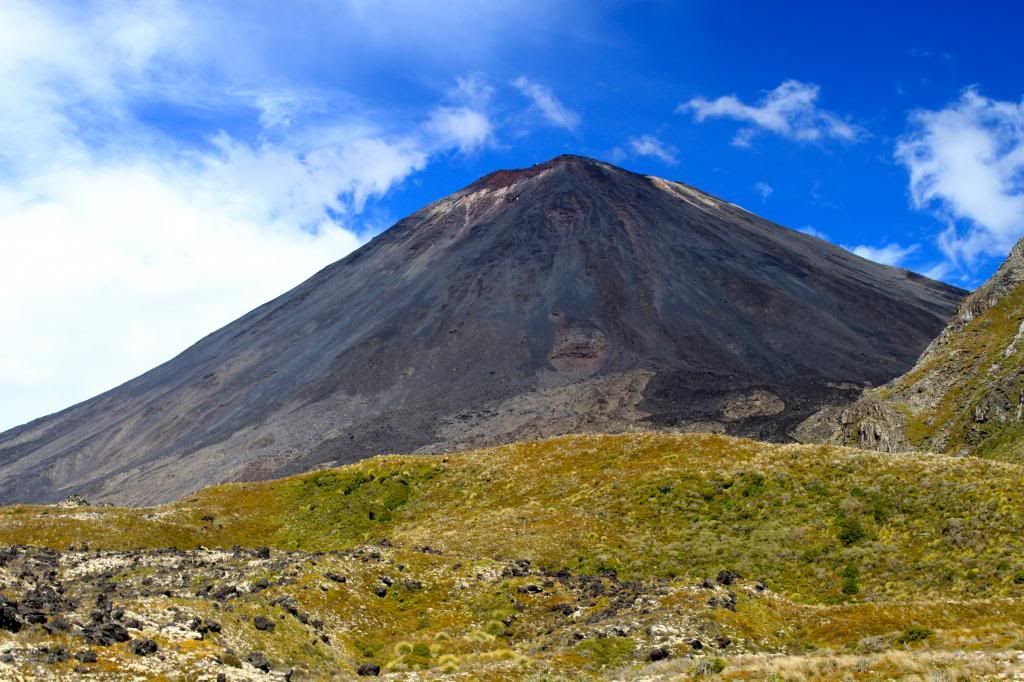 |
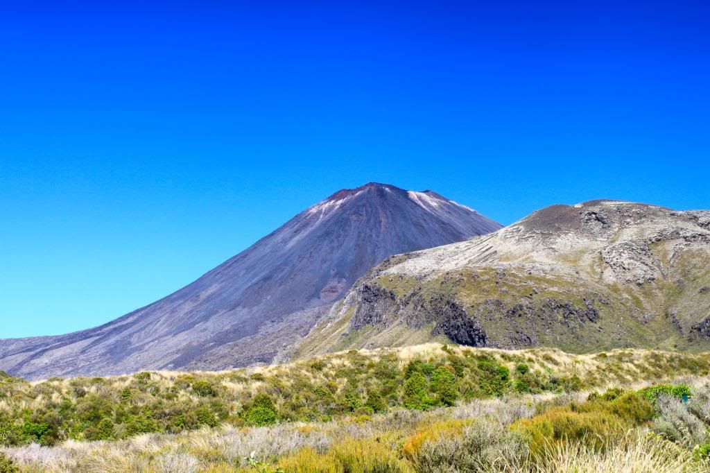
| Mt Ngauruhoe |
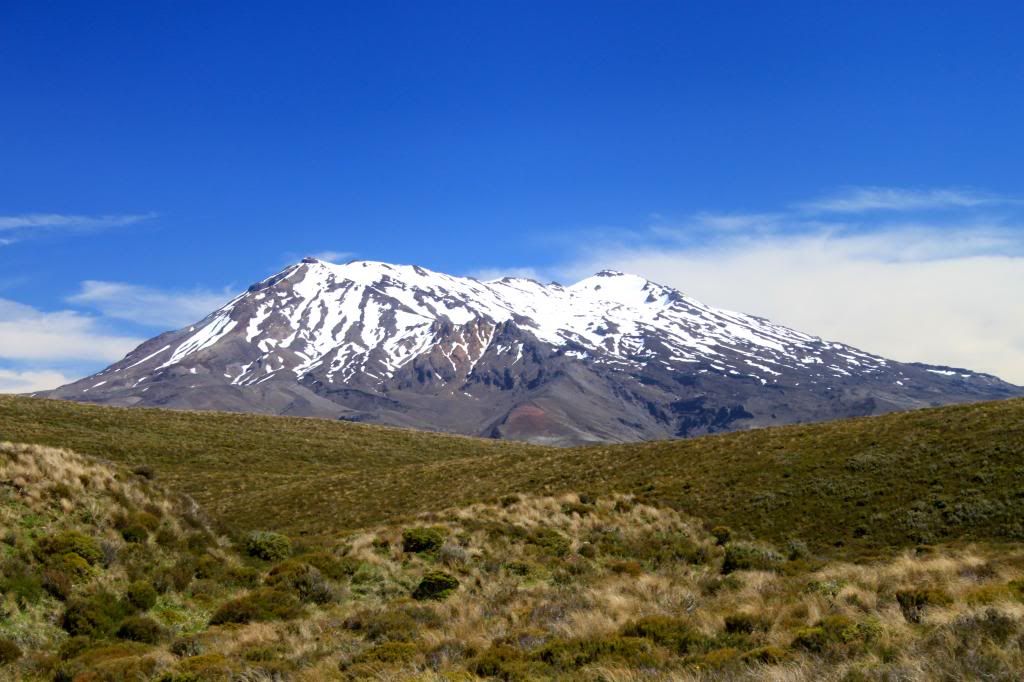 |
| Mt Ruapehu |
 |
| View before leaving on the shuttle bus. Not a single cloud in the sky. |
In the end, we felt extremely fortunate that the weather cleared. In addition, I think we had a much deeper appreciation of all that we saw on the hike because of what we endured and experienced during the first half of the trek. We felt bad for all of the people who had turned around, wishing that they had waited just a little bit longer to be rewarded with beautiful views.
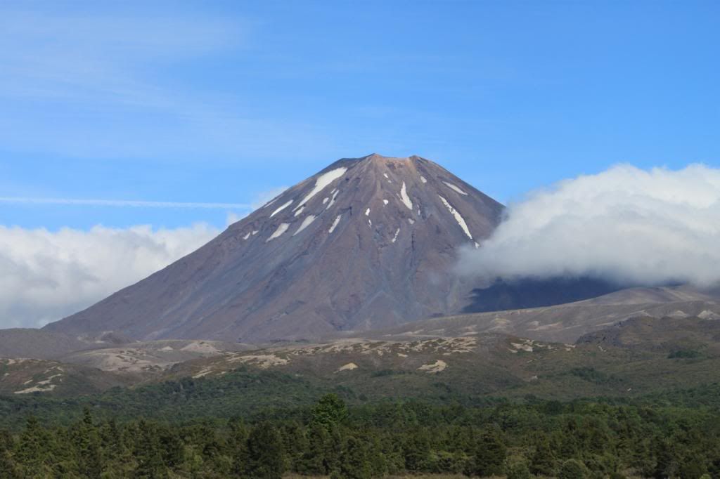 |
| The other side of Mt Ngauruhoe as seen from the road the next day. |
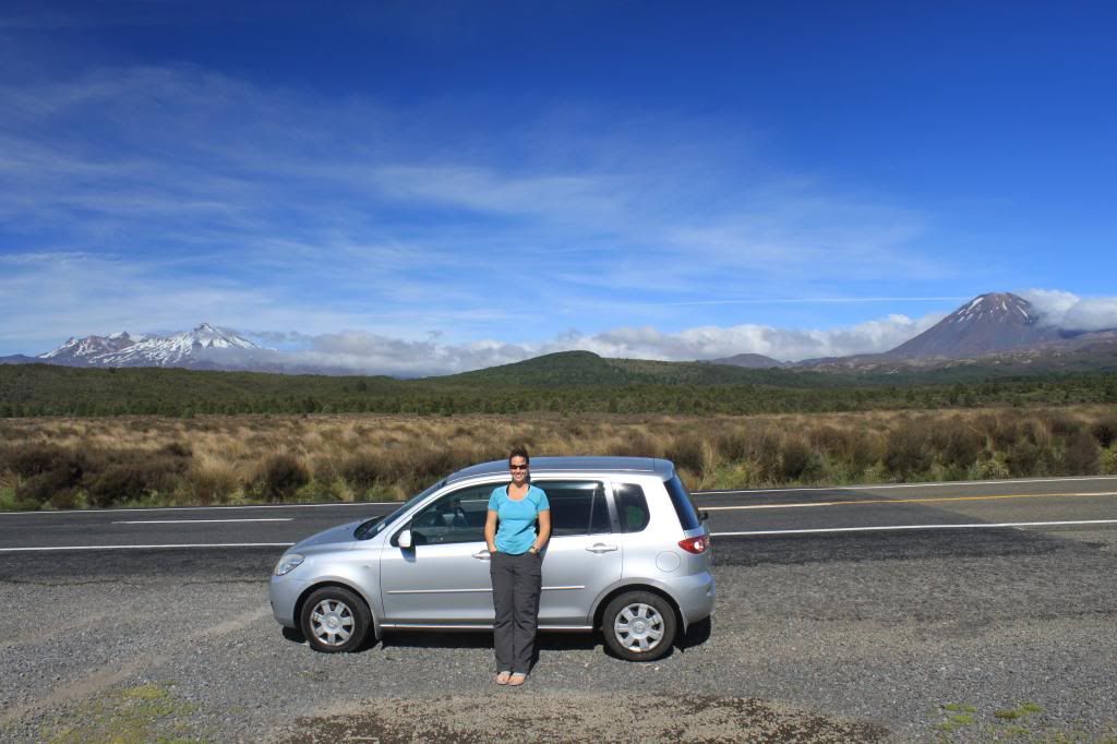 |
| Ruapehu, Ngauruhoe, me and our sweet Madza Demio leaving Tongariro National Park |
After leaving the Tongariro National Park area, we headed to Wellington, where we would catch the ferry to start our adventures on the South Island!
No comments:
Post a Comment